GPS & Geodetic Surveys
High-precision positioning using DGPS technology for control networks and large-area mapping
Precise Control Networks
GPS and geodetic surveys establish the precise coordinate framework that all other survey work depends on. We provide high-accuracy positioning services that ensure project consistency across large areas.
Our geodetic surveys ensure your project coordinates are accurate, consistent, and tied to national geodetic datums for seamless integration with existing infrastructure data.
Our GPS services include:
- Ground Control Point (GCP) establishment
- Benchmark and leveling networks
- Large area reconnaissance
- Permanent monument setting
Key Applications
Where GPS & Geodetic Surveys are Essential
GCP Establishment
Precise ground control points for aerial mapping, drone surveys, and satellite imagery georeferencing.
Benchmark Surveys
Vertical control networks for construction projects, infrastructure corridors, and elevation monitoring.
Large Area Mapping
Control networks spanning multiple kilometers for highway, railway, and transmission line projects.
Coordinate Transformation
Conversion between local and national coordinate systems, datum transformations, and projection conversions.
Boundary Surveys
Accurate boundary delineation with coordinates tied to Survey of India control points.
Infrastructure Corridors
Control networks for linear projects - roads, canals, pipelines - spanning multiple districts.
Equipment We Use

DGPS Receiver
- Horizontal accuracy:±10mm + 1ppm
- Vertical accuracy:±15mm + 1ppm
- Satellite tracking:GPS + GLONASS
- RTK mode:Capable
What You Receive
- Control point coordinates (Lat/Long & UTM)
- Point descriptions and access sketches
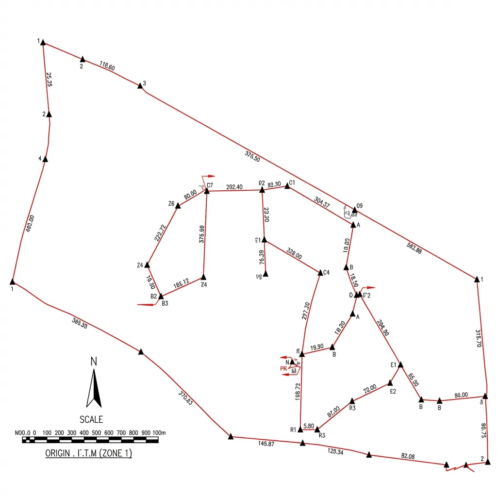
- Control network diagram
- Coordinate listing in multiple formats
- Benchmark description sheets
- GPS observation data (RINEX)
- Accuracy report and quality metrics
Need GPS Control for Your Project?
Establish a reliable coordinate framework with our high-precision DGPS surveys.